

bert_nelson1
-
Posts
22 -
Joined
-
Last visited
Content Type
Profiles
Forums
Blogs
Events
Downloads
Gallery
Store
Posts posted by bert_nelson1
-
-
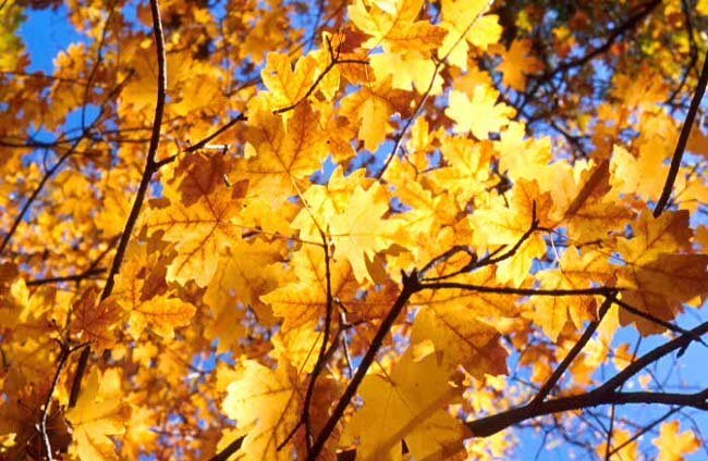
There will probably be some color during the last week of September. <br>
It is difficult to say when it will peak as that is largely dependent upon the weather, <br>
which has been extra warm of late. Your best bet is do some driving around to find the
best color. <br><br>
I would suggest the following locations (where I will be going): <br><br>
Emigration Canyon (east of Salt Lake) and then going over the hill towards East Canyon Reservoir <br>
(Directions: http://www.utahbirds.org/counties/saltlake/EmigrationCanyon.htm) <br><br>
Ogden Valley along State Route 39 past Pine View Reservoir east of Ogden <br>
Snowbasin Ski Resort (and surrounding areas) east of Ogden <br>
Monte Cristo area along State Route 39 east of Huntsville <br>
(Directions: Take I-15 north to Ogden and take the 12th street exit and head east, which is state route 39) <br><br>
Sardine Canyone between Brigham City and Logan <br>
(Directions: Take I-15 north to Brigham City and head East on route 89/91 ) <br>
Logan Canyon east of Logan <br>
(Directions: http://www.byway.org/explore/byways/2001/getting_there.html ) <br><br>
Search on +fall +colors +utah in Google and you will get a lot of web pages with
more locations, directions, etc.
-
<br>
Zion National Park - Southwestern Utah <br><br>
Specific Places: Zion Canyon, Lower Emerald Pools Trail, Virgin
River, Riverside Trail, Bridge at Zion Canyon junction<br><br>
When: Last week of October and/or First Week of November <br>
<br>
You have more flexibility in November when private cars are allowed in
Zion Canyon.<br>
<br>
<br>
<br>
<center>
<img alt="Zion2"
src="http://www.xmission.com/%7Enelsonb/zion2.jpg"
style="border: 2px solid ; width: 650px; height: 424px;"><br>
<br>
Along the Lower Emerald Pools Trail<br>
<br>
<img alt="Zion3" src="http://www.xmission.com/%7Enelsonb/zion3.jpg"
style="border: 2px solid ; width: 650px; height: 424px;"><br>
<br>
<br>
</center>
<br>
<br>
-
Last year the colors were very good the end of Sept. through
the first part of Oct. <br><br>
For Northern Utah along the Wasatch Mountains I like these areas<br><br>
1) Sardine Canyon between Brigham City and Wellsville on Route 89<br>
2) Logan Canyon east of Logan<br>
3) The Monte Cristo area, which is along route 39 east of Hunstville<br>
4) Near North Fork Park west of Eden and that whole mountainside west of Eden<br>
5) Trapper's Loop that is a short highway from Ogden Valley over to Weber Canyon. The start is just south of Pineview Resevoir.<br>
<br>
This web page below has 31 scenic fall color routes<br>
throughout Utah, and includes some in Northern Utah<br><br>
<a href="http://www.utah.com/byways/fallcolorstour.htm">http://www.utah.com/byways/fallcolorstour.htm</a>
<br><br>
The fall color hotline by the US Forest Service is at (800) 354-4595
but they are not quite turned on for this year, but I imagine any day now it will have new updates on the area fall colors.
-
One thing you should know if you do not know already is that
Bryce is much higher at 7978 feet versus 4276 feet at Zion
and so you may not be able to hit both parks and find fall colors.
"Optimal" time implies peak foilage, which varies from year to
year and at different times in Zion. For Zion Canyon the best times are around the end of October and first part of November. I was there November 5th last year and it was on the tail end of the peak, and was told that earlier in the week there was even more color, but that a storm had blown away many of the leaves. I have heard that there are some wonderful color displays in the Kolob Canyon section of the park. Kolob Canyon peaks earlier than in Zion Canyon since its elevation is a bit higher.
Some Places in Zion for Fall Foilage
1. Along the Virgin River looking west on the bridge just
before the Zion Canyon junction
2. Lower Emerald Pools Trail
3. The first portion of the Riverside Trail, which is at the end of Zion Canyon
4. Along the Virgin River at and near the last shuttle bus stop, Temple of Sinawava.<div>
 </div>
 -
<p>
Death Valley,CA Western portion (along route 190) March 13-15
<p>
The wildflower display was underwhelming compared to the
bountiful blooms last year, but that may have been the best
display in decades. Nonetheless, I did not want to go away
disappointed, and so after some asking around at the Furnace
Creek Visitor Center and looking around I found two areas with
some real quantities. Along route 190 in the western portion of
Deathy Valley National Park there is a big wooden sign anouncing the
park entrance "Death Valley National Park...etc." Just east of the
sign are two flood plains that run for some distance. It was here I
found a concentrated display of wildflowers. About 5-6 different
species could be found. 1.7 miles to the east of the same entrance
sign (which I think is still in the park)
on route 190 there is another flood plain that runs adjacent to route
190 along the eastern side of the road. I found about 15 varieties
of wildflowers there. For some I only found one example.
I found the greatest diversity along the extreme edge of the flood
plain as it undercuts the conglomerate rock. Wander along the plain
and you will be surprised what you will find. I figure the display
will be around for another week or so unless more rain falls in these
same areas.
<p>
Other places in the northern portions of the park were scarce to none
in terms of wildflowers. The "normal" rainfall is delivering less than
hoped. Some sunflower displays were south of Badwater and there were
some blooms between Ashford Mill and Jubilee pass, but they were on
the way out. A week or two earlier would have probably been ideal there.
<br><br>
<p>
Lancaster, CA (Antelope Valley California Poppy Preserve) March 16-17
<br><br>
<p>
The hills of the California Poppy Preserve are mostly void of poppies
and so I went another area I had visited last year north of the
preserve in the quest for some poppies. I found some, but not that
many. On a hill where there were scores if not hundreds of plants
last year I found just one! And it was an itty bitty one about the
size of a quarter.
<p>
From the local paper, Daily News, Antelope Valley Edition, March 17,
2006, page 1
<p>
"LANCASTER - A few poppies are blooming around the Antelope Valley but
erratic weather -- record thunrderstoms in Septemeber and October,
70-degree weather in December and February, snow in March -- may mean
a mediocre wildflower season.
<p>
The state's California Antelope Valley Reserve will open March 26,
three weeks later than last year, but buckwheat stalks are more
noticeable than poppies".
<p>
The article continues in quoting a local wildflower expert who said
that due to the number of weeds coming up currently versus the poppies
it will be tough for the poppies to make a good showing unless there
is a lot of precipitation between now and April 1.
<p?
I am not hopeful. Last year this time they were busing in the old and
the young and the parking lot was always full with orange covering
the hillsides. Now--the parking lot is vacant and mostly weeds are
all you can see from the road. I had planned to head off to Gorman in
search of more poppies but was turned back by rain and wind.
You can find *some* poppies along the edge of Lancaster Road (Avenue
I) west of the preserve, however they are few and far in between and
hardly worth the trip if you have to come any sort of distance.
<p>
My suggestion is to look at the California Poppy Preserve state park
web page at <A
HREF="http://www.parks.ca.gov/default.asp?page_id=627">http://www.parks.ca.gov/default.asp?page_id=627</A>
and call the hotline number, which is on the page for the latest news
before you head out. It seems to echo what was mentioned in the paper
that due to the poor timing of precipitation the poppy display would
be diminished.
-
> I seem to recall hearing that Death Valley was good last February
<br>
<br>
There may have been some blooming going on in Februrary, but I found
mid-March to be fantastic when I went. Different parts of the park bloom at different times.<br>
<br>
See <A HREF="http://www.nps.gov/deva/FrameSet-Wildflower.htm">http://www.nps.gov/deva/FrameSet-Wildflower.htm </A> for more details from the National Park Service on the best times for different areas of Death Valley National Park.
-
I like
Mojave Desert Wildflowers:
A Field Guide to Wildflowers, Trees, and Shrubs
of the Mojave Desert, including the Mojave
National Preserve, Death Valley National Park,
and Joshua Tree National Park
by Pam MacKay
338 pages, clear color photos of local wildflowers and plants
Great overview of the area for local flora and
also nice guide for identifying the plants.
ISBN 0-7627-1162-0
Publisher: Falcon, an imprint of Globe Pequot Press
Retail Price: $24.95
Mid-Late March is a great time to visit
Death Valley National Park for flowers or the geology
as the blooms are out and the weather is tolerable.
Last year was perhaps the best year in some decades
for the wildflower bloom. What this upcoming
year will be like depends upon the winter rains.
-
Yellowstone Wildflower Report as of July 25, 2005
When I visited Yellowstone National Park over the weekend I
found a few flowers in bloom. Paintbrush, Wallflower, Stonecrop,
Butter and Eggs, Harebell, Fireweed, Yellow Clover, Big Head Clover
Groundsel (2 species), Collumia, Shrubby Cinquefoil and one other
Cinquefoil, Buckweet, Canadian Golden Rod, Stick Geranium, Small
Sunflower, Fringed Genetian, Yellow Monkeyflower, Small Blue
Penstemon, Yellow Pond Lily, Knapweed, Common Blue-Eyed_Grass, Wood's
Rose, Small purple aster, Mountain Blue Bell, Canadian Thistle,
Lupine, Chickweed, Cow Parsnip, Orange Agoseris, Wooly Eriophyullum,
Evert's Thistle, One other purple thistle, A small Yellow Buttercup,
Wintergreen, and about ten others I was not sure what they were.
I don't know if the flowers are at peak, but apparenlty July
in general is the peak month at Yellowstone.
Where are the flowers at?
Everywhere in the park, but they are often spotty. In general the
northern portions of the park seem to have more in numbers and
variety versus the southern portion of the park. Areas where I found
larger numbers of wildflowers are shown below.
Swan Lake Flat -- South of Mammoth Hot Spring Terraces and south of
the steep winding road just preceding the Terraces. This is a huge
open meadow area that extends for some distance on either side of the
road. Pull over and start wandering. Areas on the eastern
side go into some marshy areas which provide another habitat for a
different set of wildflowers.
Firehole Lake Drive - in the Southwest portion of the park.
Road betwen Mammoth and the Northeast entrance of the park. Turn on
the short drive along here near the Roosevelt junction where the sign
is labeled "Petrified Tree 1/4" and you will be rewarded with a nice
hillside of wildflower displays and some nice areas in the nearby
valley in the burnt out area.
Southern road exiting the park from about Lewis Falls to the end of
the park boundary.
The northern road from Norris Geyer Basin to Mammoth has many areas
that are good. Find a pull over or a picnic area and start looking
around.
If you have time I would also suggest running down to Grand Teton
National Park, which is just south of Yellowstone. The area from the
northern entrace of the park to about Coulter's Bay of Jackson Lake
are blooming heavily with many wildflowers now. Further south the
flowers are few and far between.
-
I spent the last weekend there and here is my report.
In general the South is or has peaked and the North is
just coming on strong.
Below are some areas to look for wildflowers.
Southern Portion of the Park--from the area around the
Ashford Mill ruins and all along route 178 to Shoshone.
There is an explosion of wildflowers everywhere or so it seemed.
Just find a place to pull over and bring your camera.
Hell's Gate, which is on route 374, which you can get to via
route 190 or coming from Beatty, NV. It has a small parking area
with an information kiosk there. Just park and wander around
the area. The hillside across from the parking area offers
many opportunities and there is a footpath of sorts that
you can follow through here.
I found the largest variety of wildflowers to be in the northern
portion of the park along the road heading northwest towards
the Grapevine ranger station. Just pull over and explore a bit.
Some of the best displays are in the washes.
The area near around and at Furnace Creek is also great. The
grounds around the visitor center were just covered with wildflowers. There are fields of gold with small sunflowers near the roadside.
-
Any opinions on using a 81A versus a Tiffen 812 warming filter
for the red rock country of the Soutwestern states?
Thanks
-
The original poster was probably inquiring about the Albion
Basin that lies at the eastern end of Little Cottonwood Canyon
which is about 30-40 minutes east of Salt Lake City, Utah in
the Wasatch mountain range. It is well know for its abundance
of wildflowers no doubt due to the hundreds of inches of snow
that fall each winter and are a boon for Alta, Snowbird, and
Solitude ski resorts in the area.<div>
</div> -
I use my Nikon macro lenses mostly for wildflower pictures
and having autofocus on is not pratical when shooting with
even the slightest of breezes as the autofocus cannot respond
quick enough for the moving flower. Ultimately it depends upon
the subject and the environment. Having the flash on may buy more
in capturing your subject than the autofocus does. Also film speed will have an effect as well as you are able to stop down further your
apeture with say 800 film versus 100 film and get a deeper depth of field.
There is no magic bullet or tip for shooting macro. Experiment
and use what works best for your situation. No one solution
will work every time and so you need to be flexible if you want
to get that great shot you have always been looking for.
-
I may visit the Oregon coast later this summer
along the 101 highway and I was interested in
the tidal pools. Where is the best place
to obtain information about
the tidal pools such as where are the best ones
and where to get information on the tides so I can
be there at the right time.
Thanks
-
The view from
Dead Horse Point State Park
can be photographed at sunrise
or sunset, however I found sunset
to be rather disappointing versus
the more dramtatic sunrise.
<BR>
<BR>
See URL below for the Dead Horse Point State Park
link and a picture of what it
looks right after sunrise
<BR>
<BR>
<A HREF="http://www.stateparks.utah.gov/park_pages/scenicparkpage.php?id=dhsp">Dead Horse Point web page</A>
<BR>
<BR>
I suggest arriving at the park prior
to sunrise so you
can find a suitable vantage point. I like
going out on the rocks a bit and finding an
angle I like. Most pictures are taken towards
the western section of the view. The
park is about 45-50 minutes from Moab,
so plan accordingly.
-
I just got back from a couple of days a Moab and
here is the situation on wildflowers. The bloom
this year is sparse at best around Moab. I was in Moab about
the same time last year and there seemed to
be a lot more flowers out. At Arches the Rough
Mule's Ear sunflowers, common mallow and the prickly pear
cactus with yellow flowers were plentiful,
but not too many others.
Down in the Needles section of Canyonlands National
Park things were not much better. Maybe five or six
different flowers out at this time. Last year
I found plenty of Indian paintbrush, but very
few this year.
If you are looking for variety and sheer numbers
of wildflowers I suggest you leave Moab and head
towards Capital Reef National Park, which is about
1.5-2 hours west of Moab. I lost count of the number
of different wildflowers encountered, but at least
15 if not more.
Places to find flowers: Some on the Scenic Drive, and
on road side in the western section of the park on highway 24
west of the visitor's center. Your best bet is
Capitol Gorge, which is at the end of the Scenic Drive. It
is a fairly smooth and mostly flat dirt road that
has been recently graded and can be traveled by most cars.
I suggest hiking it and bringing the equipment
and some water or pull off to the side or into the wash and explore
from there. The bottom of the gorge itself is in shadown first in the
morning and lights up later in the morning, so take a few pictures
along the way or come in later.
I found the best subjects by wandering up the various dry washes
and looking around. I suggest wearing pants or put on
some repellent with plenty of DEET as the ticks are plentiful
through here. Lyme disease or other diseases are rare, but
the critters still have a mean bite.
The first week or so of May is usually the best time
for around Moab and Capital Reef is usually peaking
about 2 weeks later, but things seem to be happening
a bit earlier this year.
-
The conditions are very poor. I saw a local report on TV (Outdoors with Doug Miller on KUTV, channel 2) out of Salt Lake City talking specifically about the refuge and many areas were dried out entirely that normally have some water. There has been recent rain, but it is a drop in the ocean of what is needed to make up the difference. The ongoing drought for several years has taken its toll. See the text of this report at the URL below..read down a bit and it will start talking about the refuge.<BR><BR>
<BR> <BR>
It talks about 90% of the refuge being dry.
-
Mike:
I shoot a lot of wildflowers, which I do with either a 55 mm
or 105 mm macro lens and it always seems to be too windy.
There are a couple of things I like to do to compensate for the wind.
What I do is to pull back from the subject to maybe 1.25 feet or
even 1.5 feet instead of 6-8 inches and set the f-stop at f/16,
which then allows for a faster shutter speed. This is not a cure all,
but it allows me to get the shot of the wildflower in perfect focus
when the wind is not blowing too hard.
I also shoot mostly in the morning, which seems to help.
-
I just got back from Moab, Utah and the conditions
are very very dry. The precipiation for southern Utah
runs about 25% of normal and the state overall is in
the fourth year of a drought. These conditions make
it difficult for the wildflowers. I went to Canyonlands
(Needles section) last year and I couldn't take pictures
fast enough of all the flowers.
This year the same areas were barren and
lifeless. I had more luck finding wildflowers nearby
the Needles section of Canyonlands in a placed called
Beef Basin, which is just off the road towards Canyonlands.
Also I found some wildflowers around Arches National
Park if I looked really hard.
There are a few decent finds, but you have to rely more upon
luck than anything since populations of flowers are more
or less random over the landscape.
-
Local Radio Station KSL Radio reported at
6:05 PM Feb 1, 2002 that Fatali was sentenced
to two years probation and was banned from
Arches and Canyonlands National parks.
Fatali plead guilty earlier of several charges
for damage done to the Delicate Arch near Moab
and some damage done in Canyonlands National Park.
-
Source: Salt Lake Tribune see URL below
http://www.sltribune.com/2001/dec/12082001/utah/156120.htm
Photographer Fatali Pleads Guilty in Fires
Saturday, December 8, 2001
BY MICHAEL VIGH
THE SALT LAKE
TRIBUNE
Springdale nature photographer Michael Fatali
pleaded guilty Friday to seven federal misdemeanors
for starting fires in two Utah national parks, including a
blaze that marred sandstone underneath Delicate Arch
-- the state icon that graces some license plates.
Fatali, who started the fires to achieve dramatic
lighting effects during photo shoots, faces up to 6
months in federal prison and a $5,000 fine on each
count when he is sentenced in February. Fatali has
agreed to pay restitution to the National Park Service, a
sum that prosecutors estimate will be $16,000.
Fatali lit the fires with Duraflame logs on Sept. 18
and 19, 2000, to demonstrate to amateur photographers
"nighttime photographic techniques," he admitted in a
statement to prosecutors. The unauthorized fires
scorched and discolored sections of sandstone beneath
and next to Delicate Arch in Arches National Park,
prosecutors say.
Fatali also admitted Friday that in August 1997 he set
two fires at Canyonlands National Park that also
damaged park resources.
Prosecutor Wayne Dance said Fatali's crimes have
untold victims. Thousands of tourists visit the parks
each year.
"Our national parks are here for the enjoyment of
current and future generations," Dance said. "It's a
matter that's very serious."
Fatali declined to comment and his attorney, Kristine
Rogers, deferred comment until her client is sentenced
on Feb. 1, 2001.
In his statement to prosecutors, Fatali said he brought
aluminum pans to the shoots to contain the fire. The
pans failed, however, and the Duraflame logs burned
directly on the sandstone, causing damage directly
under and to the west and east of the arch.
Fatali also said some of the sooty, oily residue was
tracked onto the sandstone after he stomped on the
duraflame logs. Fatali told U.S. Magistrate Samuel
Alba he did not have a permit to light any of the fires.
Park visitors reported the damage to rangers the next
morning.
Officials were able to remove some of the scorch
marks immediately, but remaining scars from the fire
have proven difficult for park service employees to
eradicate.
On Aug. 12, 1997, Fatali used wood from
Canyonlands National Park to build a fire at Horsehoof
Arch. The next day, he did the same thing at a slot
canyon known as "The Joint Trail."
Fatali, 36, who is known for his stunning images of
Utah's desert landscapes, operates a gallery outside
Zion National Park in Springdale and a photography
school in nearby Rockville.
Photographer admits fire role
By Angie Welling
Deseret News staff writer
Friday, December 7, 2001
The nature photographer accused of setting fires at
Delicate Arch last year pleaded
guilty Friday in federal court.
Michael Fatali, Springdale, also pleaded guilty to
setting two fires in Canyonlands
National Park in August 1997. The 36-year-old
professional photographer faces up to six
months in prison and a $5,000 fine for each of the seven
misdemeanor counts.
Fatali also agreed to pay full restitution to the
National Park Service for damage
caused by the fires. Restoration is estimated at more
than $16,000.
On Sept. 18, 2000, Fatali led a group of amateur
photographers to Delicate Arch to
photograph the famous four-story sandstone arch, which is
the backdrop of some Utah
license plates. At his direction, Fatali's assistant and
others from the group set two fires,
one directly under the arch and another to the east of
the structure. Aluminum baking
pans brought along to contain the fire failed, and the
flames scorched and discolored the
sandstone. Fatali tried to stomp out the fires, but one
was still burning when the group left the area.
Park visitors reported the damage to rangers the next
morning.
Officials were able to remove some of the scorch marks
immediately, but remaining
scars from the fire could not be removed because an oily
or waxy stain had penetrated
the rock.
Fatali on Friday also admitted to starting two fires in
Canyonlands National Park, the
first on Aug. 12, 1997, at Horsehoof Arch and again on
Aug. 13, 1997, at the Joint Trails
Needles District. He used wood from within the park to
start the two fires, he said.
According to prosecutors, in November 2000 Fatali sent an
e-mail message to members of the photography community
apologizing for what happened, saying he
"seriously regretted" the incident. "I simply screwed
up," the message said.
Defense attorney Kristine Rogers declined to comment
Friday, saying Fatali would
make a statement after his Feb. 1, 2002, sentencing
hearing.
Assistant U.S. Attorney Wayne Dance said Fatali fully
acknowledged his criminal
conduct by pleading guilty to all seven counts as
charged.
"It's a matter that's very serious," Dance said. "All of
our national parks are for the
enjoyment of future generations."
Source: Deseret News at the URL below
http://deseretnews.com/dn/view/0,1249,355010921,00.html?


Dimness in D700 viewfinder
in Nikon
Posted
<
p>I was looking at the D700 at the store today and it was very impressive except for one thing
. When